This year for National Preparedness Month at least define what in your area puts you at risk.
Yep another year has passed and we are looking at another National Preparedness Month (NPM). It was first sponsored by the Federal Emergency Management Agency (FEMA), under the Department of Homeland Security (DHS) in 2004. Its stated purpose is to encourage American citizens to take steps to prepare for emergencies in their homes, businesses, schools and communities and is but one part of a governmental effort to strengthen the United States' preparedness capabilities.
The US national preparedness architecture encompasses prevention, protection, response, and recovery efforts to prepare the United States for all hazards – whether terrorist attack, human caused or natural disaster. It is funded through various annual “budget bills”, such as the National Defense Authorization Act (NDAA), as well as from the Department of Justice and Department of the Interior, to name a few.
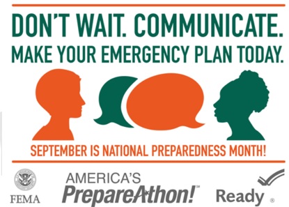
Each year there is a different theme to try and get people involved. This year (2015) it’s: Don't Wait. Communicate. Make Your Emergency Plan Today.
Yep another year has passed and we are looking at another National Preparedness Month (NPM). It was first sponsored by the Federal Emergency Management Agency (FEMA), under the Department of Homeland Security (DHS) in 2004. Its stated purpose is to encourage American citizens to take steps to prepare for emergencies in their homes, businesses, schools and communities and is but one part of a governmental effort to strengthen the United States' preparedness capabilities.
The US national preparedness architecture encompasses prevention, protection, response, and recovery efforts to prepare the United States for all hazards – whether terrorist attack, human caused or natural disaster. It is funded through various annual “budget bills”, such as the National Defense Authorization Act (NDAA), as well as from the Department of Justice and Department of the Interior, to name a few.
Each year there is a different theme to try and get people involved. This year (2015) it’s: Don't Wait. Communicate. Make Your Emergency Plan Today.
For what it’s worth, the government’s primary site for National Preparedness is at http://www.ready.gov/
What are the various risks and hazards that we might see? Or in essence, what are the odds of various things occurring where we live?
Obviously there are some areas more prone to certain types of risks, hazards or crises than other areas.
The “Ring of Fire” around the Pacific Ocean is more likely to see volcanoes and earthquakes, as well as Tsunamis. The desert southwest is more prone to drought, flash floods and dust/wind storms. We all know about the central US and central-southeast states and their potential for tornadoes and severe thunderstorms with straight line and micro/macro wind bursts. The Eastern coastal areas (Atlantic and Gulf), and to a lesser extent the west coast, are known for their hurricane and tropical storm potential and storm surge. The Great Lake states are known for Nor’easters and Lake Affect severe storms, both snow and thunderstorms. While other states are known for sink holes and others still for wildfires and landslides.
What crises are we most likely to be a close part of during our lifetimes?
Hence, it goes without saying that the first step to ANY preparedness plan is to figure out just what your area is most vulnerable to.
Now there are some places that can give you “quick views” or “dashboards” and such to keep you posted on these types of hazards, including the National Weather Service’s Weather Radio. Some even offer text and email messaging of alerts and warnings. A good rule of thumb it to utilize multiple information and notification sources.
National Oceanic and Atmospheric Administration (NOAA), National Weather Service (NWS)
National Oceanic and Atmospheric Administration (NOAA), NOAA Weather Radio All Hazards (NWR)
The Earth Observatory Global Maps National Aeronautics and Space Administration's (NASA's) Earth Observatory is part of the EOS Project Science Office located at NASA Goddard Space Flight Center, tracks things like ambient air and ocean temperatures, the ozone layer and such.
The Disaster Center The Disaster Center provides online coverage of disasters in the United States, compiling and providing links to disaster related statistics and studies, on all kinds of natural and human-caused disaster threats.
Nature's Fury NaturesFury.net is a premier Internet source for natural disaster preparedness and research, education, alerts, warnings and other resources and news.
National Oceanic and Atmospheric Administration (NOAA), Space Weather Prediction Center (SWPC)
Space Weather News and Information about the Sun-Earth Environment
Global Incident Map GlobalIcidentMap.com Tracks And Maps Terrorism Incidents And Other Suspicious Activity, Hazmat Situations, Amber Alerts, Gang Activity, Major Drug Interdictions, H1N1 Swine Flu, Plane Crashes, Threats To The President/White House, Forest Fires, etc.. For a fee and subscription to the site, you can receive full map details, alerts and warnings.
Other sites will deal with particular types of crises, like crime, invasive species or crop blights.
Keep in mind most crises are not like hurricanes where you have days to prepare, the average “crisis” won’t give you much more than a 15 minute notice! Hence the need to Be Prepared no matter where you are.
On top of that, governments are so bureaucratic and hence cumbersome, that getting help quickly is a bit of a stretch. In the US, it’s a wonder that organized help arrives within 5 days, yet alone 3!
Which are other reasons why I prefer a Needs Based Preparedness Plan vs a Crisis Based Preparedness Plan. If you want more info on this see Building a Needs Based Preparedness Plan vs a Crisis Based Plan
If you do nothing else for preparedness this month, at least find out what your area is at risk for and make some contingency plans to hold you and yours safely through at least 5-7 days without governmental or outside organized help.
To help you with this task, check out the rest of this article, which is filled with graphics and links.
For the overall odds of a particular crisis occurring that can cause injury or death (from alien invasion to various work & play incidents like dying from a drinking straw), see the following tables:
What Are the Odds? Odds of Occurring in Percentages per Lifetime or Century; This table is in % per average Lifetime (75 years) or Century
What Are the Odds? Odds of Event Occurring “1 in” Per Lifetime or Century, This table is the “1 in” odds per average Lifetime (75 years) or Century
Both of these tables are sorted by the most likely to occur to the least likely to occur.
What Are the Odds? General Number of Recorded Occurrences and or Mortality Information; This table contains general information on the occurrences to date, of most of these various events
What Are the Odds? Risk Maps (graphics only) from Amber Alerts to Zoological, for all of us ‘visual’ type people is a bunch of charts or graphics arranged kinda by date, on all kinds of things from risks, crime rates and trust, to cost of various past events, taxes, mortality causes and general economy; what state gets the most government funds, Federal Court districts, as well as time zones and the like:
I know all these tables are kind of “dry” and “dull”, so I have broken them up with some related graphics. Through all of this keep in mind that research has rarely, if ever, been known to be quick or easy. I’m helping you out here by sharing the results of all of my research to date.
Again, if you do nothing else this month, take the time to check out these documents and determine what kind of risks your area is susceptible to.
Next week we will get back to our Finding Money for Preparedness series, covering entertainment savings
Until then Keep On Preppin'
What are the various risks and hazards that we might see? Or in essence, what are the odds of various things occurring where we live?
Obviously there are some areas more prone to certain types of risks, hazards or crises than other areas.
The “Ring of Fire” around the Pacific Ocean is more likely to see volcanoes and earthquakes, as well as Tsunamis. The desert southwest is more prone to drought, flash floods and dust/wind storms. We all know about the central US and central-southeast states and their potential for tornadoes and severe thunderstorms with straight line and micro/macro wind bursts. The Eastern coastal areas (Atlantic and Gulf), and to a lesser extent the west coast, are known for their hurricane and tropical storm potential and storm surge. The Great Lake states are known for Nor’easters and Lake Affect severe storms, both snow and thunderstorms. While other states are known for sink holes and others still for wildfires and landslides.
What crises are we most likely to be a close part of during our lifetimes?
- Fire, to our home with us home or not, or to our schools, stores or work places and wild/forest/brush fires.
- Crime, home invasion, burglary, while home or not, or to someone in our household while out and about.
- Illness or Injury to a member of our household.
- Personal Financial Crisis of some sort to a member of our household.
Hence, it goes without saying that the first step to ANY preparedness plan is to figure out just what your area is most vulnerable to.
Now there are some places that can give you “quick views” or “dashboards” and such to keep you posted on these types of hazards, including the National Weather Service’s Weather Radio. Some even offer text and email messaging of alerts and warnings. A good rule of thumb it to utilize multiple information and notification sources.
National Oceanic and Atmospheric Administration (NOAA), National Weather Service (NWS)
National Oceanic and Atmospheric Administration (NOAA), NOAA Weather Radio All Hazards (NWR)
The Earth Observatory Global Maps National Aeronautics and Space Administration's (NASA's) Earth Observatory is part of the EOS Project Science Office located at NASA Goddard Space Flight Center, tracks things like ambient air and ocean temperatures, the ozone layer and such.
The Disaster Center The Disaster Center provides online coverage of disasters in the United States, compiling and providing links to disaster related statistics and studies, on all kinds of natural and human-caused disaster threats.
Nature's Fury NaturesFury.net is a premier Internet source for natural disaster preparedness and research, education, alerts, warnings and other resources and news.
National Oceanic and Atmospheric Administration (NOAA), Space Weather Prediction Center (SWPC)
Space Weather News and Information about the Sun-Earth Environment
Global Incident Map GlobalIcidentMap.com Tracks And Maps Terrorism Incidents And Other Suspicious Activity, Hazmat Situations, Amber Alerts, Gang Activity, Major Drug Interdictions, H1N1 Swine Flu, Plane Crashes, Threats To The President/White House, Forest Fires, etc.. For a fee and subscription to the site, you can receive full map details, alerts and warnings.
Other sites will deal with particular types of crises, like crime, invasive species or crop blights.
- US Invasive Species (all)
- US Invasive Plant Atlas
- US Aquatic Invasive Species
- National Invasive Species Information Center Aquatic home page
- National Invasive Species Information Center Plants
- National Invasive Species Information Center Animals
- National Invasive Species Information Center Microbes
- National Invasive Species Information Center State Resources
- US FBI Crime Statistics (includes terrorism)
- US Crime Statistics by State and City
- US Uniform Crime Reporting Statistics
- National Terrorism Advisory System (NTAS)
Keep in mind most crises are not like hurricanes where you have days to prepare, the average “crisis” won’t give you much more than a 15 minute notice! Hence the need to Be Prepared no matter where you are.
On top of that, governments are so bureaucratic and hence cumbersome, that getting help quickly is a bit of a stretch. In the US, it’s a wonder that organized help arrives within 5 days, yet alone 3!
Which are other reasons why I prefer a Needs Based Preparedness Plan vs a Crisis Based Preparedness Plan. If you want more info on this see Building a Needs Based Preparedness Plan vs a Crisis Based Plan
If you do nothing else for preparedness this month, at least find out what your area is at risk for and make some contingency plans to hold you and yours safely through at least 5-7 days without governmental or outside organized help.
To help you with this task, check out the rest of this article, which is filled with graphics and links.
For the overall odds of a particular crisis occurring that can cause injury or death (from alien invasion to various work & play incidents like dying from a drinking straw), see the following tables:
What Are the Odds? Odds of Occurring in Percentages per Lifetime or Century; This table is in % per average Lifetime (75 years) or Century
What Are the Odds? Odds of Event Occurring “1 in” Per Lifetime or Century, This table is the “1 in” odds per average Lifetime (75 years) or Century
Both of these tables are sorted by the most likely to occur to the least likely to occur.
What Are the Odds? General Number of Recorded Occurrences and or Mortality Information; This table contains general information on the occurrences to date, of most of these various events
What Are the Odds? Risk Maps (graphics only) from Amber Alerts to Zoological, for all of us ‘visual’ type people is a bunch of charts or graphics arranged kinda by date, on all kinds of things from risks, crime rates and trust, to cost of various past events, taxes, mortality causes and general economy; what state gets the most government funds, Federal Court districts, as well as time zones and the like:
- What Are the Odds? Risk Maps and Prep Info (graphics only) Part 1
- What Are the Odds? Risk Maps and Prep Info (graphics only) Part 2
- What Are the Odds? Risk Maps and Prep Info (graphics only) Part 3
- What Are the Odds? Risk Maps and Prep Info (graphics only) Part 4
- What Are the Odds? Risk Maps and Prep Info (graphics only) Part 5
- What Are the Odds? Risk Maps and Prep Info (graphics only) Part 6
- What Are the Odds? Risk Maps and Prep Info (graphics only) Part 7
- What Are the Odds? Risk Maps and Prep Info (graphics only) Part 8
- What Are the Odds? Risk Maps and Prep Info (graphics only) Part 9
I know all these tables are kind of “dry” and “dull”, so I have broken them up with some related graphics. Through all of this keep in mind that research has rarely, if ever, been known to be quick or easy. I’m helping you out here by sharing the results of all of my research to date.
Again, if you do nothing else this month, take the time to check out these documents and determine what kind of risks your area is susceptible to.
Next week we will get back to our Finding Money for Preparedness series, covering entertainment savings
Until then Keep On Preppin'
 RSS Feed
